One of my endearing memories is standing in the cupola of the tank talking on the wireless set with a mug of tea in one hand and a map in the other. All three were indispensable but the map was also my friend. It told me where I was and how to get to my destination. It told me what features the ‘enemy’ could defend and how best to approach them without exposing my tanks. It also told me where there was a clump of trees to conceal my troops and the names of all the villages in the area. With the grids on the map I could register the ‘enemies’ location which the aircraft and artillery could engage with accuracy. The map we were taught to ‘read’ at the military academy had a scale of one-inch i.e. an inch on the map corresponded to 1000 yards on the ground. Therefore, it contained detailed information e.g. single huts, lone trees, contours spaced out at a 100 yards – in short all the necessary information for the commanders and troops of a tactical units within an accuracy of 6 yards.
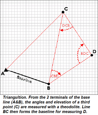
A survey commences with marking and measuring a baseline. From the two terminals of the base line (A&B), the angles and elevation of a third point (C) are measured with a theodolite thus forming a triangle. The length of the sides i.e. the distances AC and BC can be calculated with trigonometry. Line BC forms the next baseline to measure point D and so on. This seemingly simple process is called triangulation. However, the larger the area to be surveyed, the bigger the base line should be and more accurate its measurement.
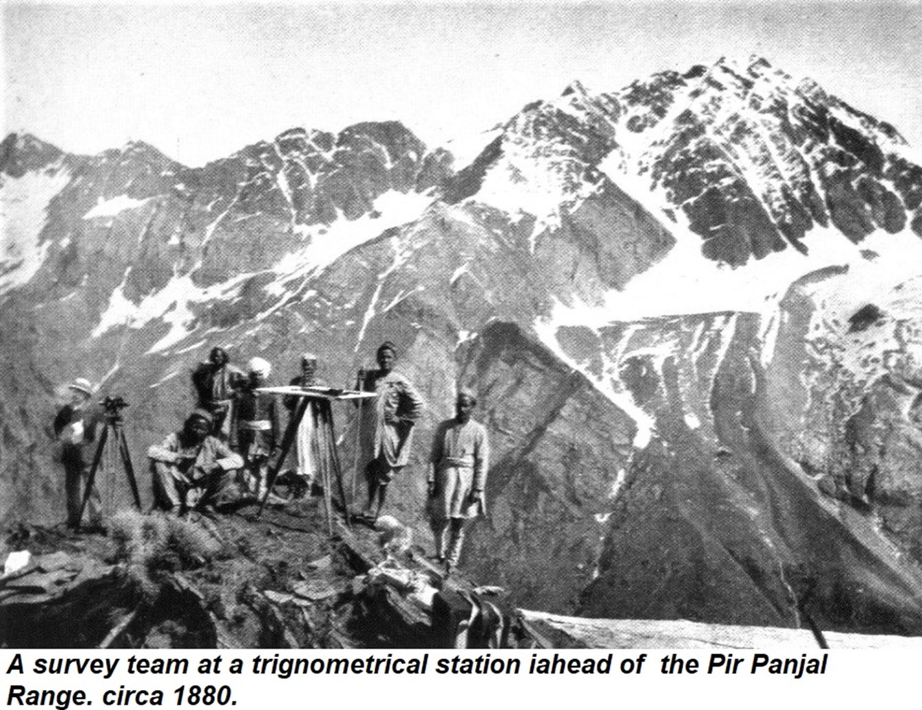
Afterwards, as the parties penetrated into the mountains, the height of the stations averaged 17,000 feet, and luminous signals were used from peaks, 19,000 and even 20,000 feet above the sea.’ During the survey of the Kashmir Series, Montgomerie fixed the height of Nanga Parbat and Rakaposhi, and when he extended it onwards to the Karakorum, he fixed the height of a peak registered as K 2, at 28,290 feet.
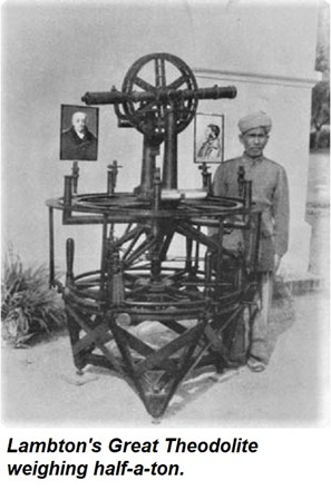
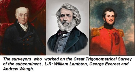
One cannot but admire the dedication and energy of these Surveyor Generals and their teams who most of the time worked under harsh conditions to map the Indian Subcontinent. The results they produced were so accurate that when their surveys were checked with modern instruments, a century later, it is not surprising that the variations were miniscule.
Indian resteraunts continued to serve customers during the Second World War but curry powder, herbs and spices were difficult to acquire and probably for this reason, the choice of Indian dishes were limited. A menu card of Veeraswamy had only one choice of an ‘Indian’ serving – pigeon, rabbit, lamb, or veggie curry with Burma rice, poppadums, and mango chutney. The rest of the menu consisted of traditional British fare such as braised lamb, rabbit chasseur, chicken cutlets, etc. During the war, the well-to-do in London continued to enjoy nearly the same standards of cuisine at top restaurants that were available before the war. This caused such discontent that the government banned eateries from charging more than 5 Shillings (or a quarter of a Pound), for each meal. Consequently, that’s what a full course lunch cost at Veeraswamy, but coffee was an extra shilling.